Journal de géocaching
USA 2012

Trace géocachique d'un séjour dans le sud-ouest américain en Californie, Névada, Arizona et Utah. Beaucoups de caches virtuelles (parcs nationaux obligent) dont quelques-unes se méritent!

Lundi 6 août 2012

After landing at SFO directly from Europe, we stopped at the parking nearby to optimize the placement of the luggages in our rental car and of course have a good view on the bay (especially Coyote Point where I used to windsurf many, many years ago). Jet lagged and tired, our eyes couldn't find the micro when we search the possible locations and we didn't insist much, wanting to go rapidly to our hotel in San Francisco.

Anyway thanks for pointing to this great location.

No planes in that direction!

Mardi 7 août 2012

The building was situated between our hotel in SF and the parking we used. While passing by carrying our luggages, we noticed a possible location corresponding to some elements of the hints. Next morning, awaken because of jetlag, I went to search to cache hoping for the absence of muggles but some early bird customers of the establishment nearby had nothing better to do than watching what was happening in the street and I didn't dare searching for the cache :-(

Thanks for showing us the building although we think the title of the cache is a bit harsh!

Beauty and ugliness?
Looking better from this side?

We found the cache as part of a nice day of tourism in San Francisco : from Market Street to the wharfs through Union Square, Chinatown and various hills. It was good to walk again in this town especially with a nice and clear summer day.

Going up the hill and the tower was good to keep up in shape for more nature oriented hikes in the national parks later in our vacations! The mural are very instructive of the events and the life of the time and add to the interest of the location.

Thank you for "geomarking" this favorite spot in SF.

A nice rural mural
Different kinds of sailors
San Francisco icon : the pyramid
San Francisco icon : the bridge
San Francisco icon : the prison
San Francisco icon : the street

Mercredi 8 août 2012

Leaving San Francisco for Yosemite, one summer morning, we decided to stop at Alamo Square to enjoy the classical view on the Painted Ladies and downtown skyline. Having a cache here really makes it easier to navigate to the spot!

Not many tourists were walking the lawn still covered with dew : the park was rather occupied by people walking their dogs, jogging or practicing tai chi chuan. Very nice and very quiet atmosphere.

Thanks for that iconic view of San Francisco

One more picture after the millions already taken!
A nice park in a nice neighborhood in a nice city

Jeudi 9 août 2012

We went up the Mist Trail in the morning, on our way up to Half Dome. No need to put on our raincoat on as the mist didn't reach the trail, no nice rainbow effects as the sun didn't reach the falls yet.

As the other big fall in Yosemite valley are dry, the Mist Trailwas the only opportunity to experience the power of water and its effect on the landscape.

We identified the bodies of water that one can't name but in the morning we didn't miss the capability to swim. In the late afternoon, we understood why it can be very tempting (and so dangerous) to relax in the water!

Thanks for the cache highlighting a great trail.

Vernal with little mist
Important warning
Nevada without mist
On the way back, don't slide!

When we planned our vacations in the US this year, we participated to the Hald Dome lottery as soon as possible and obtained a permit to go up the cables.

Doing this hike two days after landing from Europe in San Francisco, still jetlagged and with high temperatures proved a bit stenuous (and surprisingly more difficult than the same ascend 28 years ago :-) ) but we made it to Half Dome and enjoyed the beautiful situation and views.

Thank you for this cache that can record one of the highlights (both in altitude and exhilaration) of our trip

Required proof
Keeping anonymity on the web
Ruins and land art
Happy geocacher or proud hiker?
Panorama : Great view on the wilderness

While hiking up to the top of Half Dome we were quite focused on our goal when I passed this cache. We just stopped to have a look on what was ahead of us and gather some energy for next hour!

Going down, although we knew we still had a long hike back to the valley floor, we were more relaxed and thus took time to think about the answers of this virtual.

It is quite a nice spot with good perspective and a very useful one for those who may unfortunately need to be rescued! They wasn't any incident that day : the weather was just glorious (a bit hot though to climb on top of mountains!)

Thanks for this life saving cache

Nice view on large expenses of wilderness
One thumb but how many step to the top?

On the way up to Half Dome, we just went directly on the trail to the Little Yosemite Valley as we were anxious to attain our highest goal first!

On the hike back, doing some fine caches was a way to add some fun to what seemed as long walk to our cabin!

The location of the cache is great to feel the power of the falls. When we were there, they was no mist to cool us in the area.

Yosemite is a perfect mix of rocks, water and trees and the cache has all these ingredients along with the best hike (if you make it to the Dome!): thank you!

One of the nice views of the hike
Who put these boulders there?
Nice fall

We started to do the cache in the afternoon on our way back from Half Dome : our legs were beginning to loose flexibility and our brain was more focused on the promise of relaxation at the end of the trail than on relaxation joints!

It's sometime difficult to imagine the geological phenomena but it's easier if you do it directly on the spot, with some explanations and graphics.

Thank you for helping us understand the landscape. Not shure we got everything : we'll have to come back some day in this fine valley and trail.

Jumping the top step
small steps for man, one giant leap for the valley

During the day in this part of the park, we saw different forms of erosion : exfoliation on the domes, plucking by glacier, polish by water. The talus slope is another one, less spectacular and sometime very difficult to cross!

When we arrived at the cache, the sun had left the valley for some time. In the morning, we found that the trail was too well maintained; in the evening, after walking a few kilometers, we appreciated that the trail was so accessible. We were able to look up for the indices without risking to fall!

Thank you for the nice earthcaches we discovers that day.

Some rest before finishing the hike
We should have take a skate board!
The sun is leaving the valley

Vendredi 10 août 2012

En route for a late afternoon visit to Glacier point to enjoy sunset over Yosemite valley and the Sierras, we stop at this cache that provides a truly amazing view on the Little Yosemite valley, its waterfalls (the only ones in the valley at that time of year) and the surrounding domes and pics. From this viewpoint, one wonder how one can climb Half Dome!

Thanks you for spotting this nice panorama.

A very dramatic scenery
Nice view on Vernal Fall and Emerald Pool

When walking up the Giant Staircase one can appreciate the impressive size of each step but it's difficult go get a global view of the landscape configuration. When watching it from above, the waterfalls don't look so impressive but one can clearly understand the various geological elements of the valley. It is also interesting to discover how Half Dome's shape changes when one rotates around it.

We went to the cache location before going to Glacier Point and enjoy the changing colors and the ranger's talk. We also watch some photographers preparing for the night as the Perseids were scheduled for around 4 o'clock in the morning and they wanted to shoot nice pictures of them with Half Dome as background.

Thank you for this earthcache that complement those we didn't on the trail the day before.

Overlooking Nevada Fall
River going down a staircase
The Visor, best location for pictures on Half Dome

Samedi 11 août 2012

During our stay in Yosemite, we stop to enjoy the view 3 times : one going for sunset on Glacier Point, one going down after dark and one leaving Yosemite through the south exit. We checked the geocache on the last occasion thus we did a "Into the Darkness, out of Yosemite Valley!" cache.

This scenery was as gorgeous as we remembered from previous visits in the valley but it was the first time that the veil of the bride was so small and unimpressive! When we were there at night, we saw some moving lights in the area above the falls but couldn't find if they were on a trail or in the wilderness.

Thank you for this nice way to say goodbye to the valley

Yosemite Valley and GPS
The best landmark in Yosemite
Geocacher in action

Dimanche 12 août 2012

We really enjoyed walking among such huge trees in Grant Grove and Giant Forest. It's a pity one can get closer to General Sherman but we understand that it must be protected from the humans hords visiting the area!

We especially appreciated the spot where the "footprint" of General Sherman is paved on the trail! And that one of the languages is french!

Thank you for this nice virtual cache in an impressive forest.

Sunset on another giant, Gal Grant
Difficult to have this giant on a single picture!
A fallen branch bigger than many big trees!

After Half Dome in Yosemite, Moro Rock in Sequoia: we really appreciate climbing these domes, to enjoy the great trail that enables us to go to places otherwise accessible only to climbers and to marvel at the views from the top.

Moro Rock is special with mixed views to the sierras, to a canyon and to the large central valley.

Thanks you for the hike and the interesting information.

Great trail
Climbing or hiking?
A forest on Mori Rock?
Interesting encounter somewhere below the rock
Panorama : What a view!

As we had a long trip to do between Sequoia National Park and Death Valley, we wouldn't have stopped there without a cache!

Very interesting place to learn more of the old way of life in the area (and modern one as lots of families were picnicking and bathing there!).

We were glad to see that the grinding stone and the petrographs were well preserved despite being so close to the road!

Thank for placing the cache at such an interesting spot and for teaching us what's an ER (it may be useful some day!).

Great view on where we came from
Great rock
Hole in the rock

Lundi 13 août 2012

We decide to visit the south east lower part of Death Valley before breakfast : a compromise between good light with the sun shining and temperatures fitted for normal human beings. We've already been there in a summer afternoon years ago and we wanted to be able to stay outside for more than a few minutes that time!

We think we were the second car to reach the spot for that day but as we enjoyed walking on the salt, the flow of tourists wanted to experience this sea below sea level started seriously.

The salt formations seem so fragile, it's a pity some people don't respect the protected area just to shot a good picture : how long will it take for the environment to recover!

Our GPS was not very good at measuring altitude as it indicated -105m, much lower than the official record!

Thank for this very special cache

No waves!
Minerals growing to imitate life!
Natural modern art

In our trip in south west US, we've seen lots of golf courses in desertic or semi-desertic area, artificially created and maintained. It's good to see a location where no evil promoter will dare create a putting green. Playing there is truly reserved for some extreme and lasting torture, on par with Sisyphus' Rock or the Danaides' Vase!

It was fun to experience the landscape at several distances : it seems to be fractal with mountains appearing when zooming in!

Thanks for the cache that is unique : it feels like being at the very core of the valley.

Ready to walk the valley floor?
A valley within the valley

Last cache before breakfast for our early morning visit in the south east of Furnace Creek. We avoided the hottest temperatures of that day (around 115F) but the light didn't allowed us to take pictures that truly render all the various subtle color differences of the Pallet.

Having information on the physical and chemical processes involved in the creation of such colors adds to the interest of the location : nature is truly the greatest artist!

Thanks for this chromatic earthcache

Approaching the pallet
No information panel : just do the earthcache!
Artist pallet or sugared cake?
Don't look back : a Marcel Duchamp installation?

After an early visit (we started before sunrise) of the valley in the Badwater area, a nice breakfast and some moments enjoying a nice swimming pool, we were ready for more visits in the heat!

When watching the nice locomotive, we had some thoughts for the builders of the railroad and for the train conductors that add to confront the heat of the boiler in addition to the natural furnace of the valley.

Tanks for this little piece of history

Nice piece of machinery
Other nice piece of machinery
Not so bad for a summer day

After parking our car near Luke Skywalker' X34 Landspeeder, we prepared for a short walk trying to find a good place to setup a wind farm in the dunes.

Our party spotted a nice spot at N 36 36.665 W 117 97.023 near a kind of barkhan dune and measured a SE wind there. We uploaded the required information to the planet's authorities and then left the location to avoid a close encounter with Tusken Raiders.

It was both an honor and a pleasure to be chosen for this mission in what seemed a galaxy far far away from our usual surroundings: thanks!

The geotagged dune
That's neither R2D2's nor C3PO's track!

Visiting the dune field in the afternoon, we really experienced a heat shock (temperatures over 110F) when leaving our confortable car to set foot on hot sand. When walking in areas without shade, we use tagelmusts as protection : in this kind of landscape, it transported us back to the Sahara where we bought them on a local market, years ago.

Later in our vacation, we did another earthcache related to dunes (Coral Pink, with ATV allowed to play there!). We also did another one in France (Pyla). A quick keyword search on www.geocaching.com indicates that we could search at least a hundred other dune earthcaches, on all continents!

Reading the earthcache explanation lead us to play with a dune simulator on the web, trying to generate star and barkhan dunes!

Thank you for the captivating earthcache

Hard soil under the sand
Some plants may help fix the dunes
Small heat tornado toward the village

After an early morning visit in the Badwaters area and in Furnace Creek, we had enough time go visit Zabriskie Point before going to the Mesquite dunes area. We enjoyed nice views of this eroded landscape from above (wondering why badlands are often beautiful) but we didn't have enough time to hike down this amazing geological formations (and didn't feel like walking to far under temperatures around 113°F).

Thanks for this cache that mixes science, nature and art.

Checking the thermometer
Another artist' pallet
Ready to hike down the furnace?
Stunning panorama

Mercredi 15 août 2012

After going down the South Kaibab trail in the morning, we spent the rest of the day lazily exploring the area around Bright Angel campground and Phantom Ranch. We enjoyed reading in the shade, cooling in the creek, drinking great lemonades, listening to a park ranger, searching for scorpions using black light, sleeping under the stars and geocaching!

Part of the fun of hiking in the Grand Canyon is to escape from too much technology (except a GPS receiver and a camera of course!). Nevertheless, it was fun to discover the useful technology deployed across the canyon.

Thank you for this discovery.

The cache is somewhere in the oasis below
The easiest way to get to the cache?
No, there is no regular cache at the bottom!

After a very quiet afternoon to cope with the heat in the shade of the campground, at the ranch or in the middle of Bright Angel creek, early evening had ideal temperatures to visit the banks of the Colorado, the two bridges that crosses it, the ruins of the Pueblo village and the Rees' tomb.

Thanks for this tribute cache

Going down to the cache on the great Kaibab trail
Great works for a great trail
Work of art
GPS and tomb

Jeudi 16 août 2012

Going from Bright Angel Campground to Indian Garden Campground, we have time to stop, log in the book and wet our hats and bandanas, following a ranger's advice. We wonder who is going to read all the entries in the book?

Thanks for setting this cache for hikers, riders and canyoners!

The easy way to get to the cache : a motor raft
Please geocache!

After an easy morning hike from the Colorado to Indian Garden and an afternoon resting under the trees, no better way to finish the day than a sunset walk to Plateau Point. Much less crowded that sunset viewing from the rim : only 3 group involved including ours! The sky was quite cloudy and the sun couldn't inflame the whole canyon but we still enjoyed nice colors effects on the cliffs.

Thank you for this nice virtual cache at a perfect location to appreciate the canyon.

Approaching the end of the plateau
There's water on the plateau!
Great overlook
Sunset from Plateau Point, to the north east
Sunset from Plateau Point, to the south east
Sunset from Plateau Point, to the west

Vendredi 17 août 2012

28 years after first hiking down the Grand Canyon, I returned with my wife and kids. As I find that sleeping below the rim is fantastic, we did it the easy way with a night at Bright Angel campground and a second one at Indian Garden featuring a sunset walk to Plateau point.

I forgot to enter the additional waypoints in my GPS before going down so we missed the spot north of Phantom ranch and didn't took our picture at the exact spots: we'll need to go back there in 28 years!

Many thanks for this virtual multi-cache that encourages people to spend more time enjoying the Grand Canyon from the inside.

1) The easy part : going down some steps
2) Last time to change one's mind
2 bis) The area is under a revegetation program!
3) Forgot to take a pictures of the lemonades!
3 bis) Night show at Phantom Ranch
4a) How can one leave garbage in this shelter?
5) Straying down or going back to civilization?
5 bis) Sunset from Plateau Point
5 ter) Nightfall inside the canyon
6) "Radieux comme des anges" after the hike
6 bis) Impressive trail with its two resthouse

Samedi 18 août 2012

The day before, after watching sunset at Hopi Point, we tried to search for the Grand Canyon Explorers but afraid to miss the last shuttle, we had to catch the bus without going to the cache coordinates.

We came back in the morning and enjoyed the great views on a familliar part of the canyon as we've hike down the days before.

We discovered who were the explorers. During our vacations in Utah and Arizona, we crossed many times the memories of their leader, a remarkable man with remarkable achievements and with a very modern approach to nature and civilization. We'll try to find a book to better understand his adventures.

Thanks for this tribute to great courageous men.

Grand Canyon, GPS and hand
Great views to the west

During our stay at the South Rim we went twice to Hopi Point, once in the evening, once in the morning.

As it is supposed to be the favorite sunset viewpoint in the whole area, in the evening, the immediate location of the cache was already preempted by lots of people and we choose to find another good view point to enjoy the sunset. It didn't turn as reddish as the day before at Plateau Point but we had some nice lightning strikes to the east and the north : unfortunately, these are quite impossible to shot without proper photographic equipment!

The next morning, we came back as part of our daylight rim exploration. Much less people around but not much time spent to optimize the shuttle hops!

Seeing such scenery as Grand Canyon, one can hope that humans will take more time enjoying in peace the marvels of the world that quarreling and fighting against each other. Peace on the rim indeed!

Thanks for the cache on such a splendid spot

Nice light before the storm
Waiting for sunset
Tourists are very strong to bend the railing
Ready for some lightning illuminations

Lundi 20 août 2012

After a good night at the campground (only 2 sites were occupied), we hiked down to Betatakin ruins. We had to use Navajo time to be on time at the meeting with the volunteer that lead us to the site : we were the only party that morning making it easier to translate the explanation in French for the family!

The hike provided great view to the canyons (Betatakin and the start of the trail to Keet Seel), to the valley where the people used to grow some crop, to the rare aspen forest, to the alcove (although we couldn't approach the buildings) and to the petroglyphs and petrographs nearby.

Late that day, before leaving the National Monument to go to Shonto and Page, we went along the Sandal trail to better appreciate the canyon and the site from above (and to gather the info to log the virtual cache!).

Thank you for the great cache : we really enjoyed coming to this beautiful and quiet area.

Going down the canyon on a "New deal" trail
Canyon confluence
A scorpion under a grinding stone
The Betatakin village
Under the alcove
A petroglyph
A petrograph
The cache site from below
At the cache site
Great panorama

Mardi 21 août 2012

We didn't tried to visit the dam while staying at Page so this cache was appropriate to have a good view at it.

From there, the Colorado seems to gently begin its way down to Hoover Dam.

Thanks for bringing us to this nice spot.

Preparing to go all the way down to lake Mead?
Nice rock formation
Glen Canyon and rain over Vermillion Cliffs?

Mercredi 22 août 2012

When we planned our visit in south west USA from France, we organized our visit to include the "big" national park but left some room for other visits, to be decided during the vacation. So, staying at Kanab and having a permit for the day after at North Coyote Buttes in Vermillion Cliffs NM, we decide to explore another National Monument we didn't know.

The visit of Pipe Spring was a very nice surprise : the area was very quiet, it was in a reservation, it had a nice museum and a nice garden with some experiments going on, it featured a mix of nature and history both from the native american and the mormon perpective, we crossed John Wesley Powel tracks once again, we enjoyed to walk up the hill and the large view on the Arizona Strip plains, we learned new things on the way people lived in the area at the end of the XIX century, we bought nice souvenirs! As a bonus, our party of four was alone with the ranger to visit the "castle" so it was easier to do simultaneous translation from American to French!

Like Betatakin in the Navajo Reservation, Pipe Spring will remain as a less known but not the less appreciated gem of our trip.

Thank you for pointing to such a quiet and human place

The stove (no picture for the one inside, sorry)
The castle (Winsor not Windsor!)
The pole (one every 70 yds for hundreds of miles!)
the spring (going through the wall in a pipe?)
The pool (must have been a luxury in the old days)
Panorama : The plain (imagine grass instead of des

After exploring yellow dunes in Death Valley, we wanted to see pink ones! We were surprised to discover that motor vehicles were allowed to go on the dunes but we hope it's a good example of coexistence of different form of outdoor activities.

We didn't spend much time in the park as we had to go back to Kanab and as rain was coming but we appreciated to walk almost alone the closest sand slopes.

Thank you for the explanations and the cache.

Pink road to pink dunes
Hardened pink sand forming a nice slickrock area
GPS at Coral Pink
Surviving in the desert dunes
An artist driver
Rain's coming
More rain's coming

After a late afternoon walk in Kanab and a quick diner, we searched for a cache that was not far from our motel. During our vacation in south west USA we've seen a lot of place visited by John Wesley Powell : exploring such a large area in a somewhat hostile nature without a GPS, what an adventure!

Thank you for bringing us on his tracks once again!

Scenic Kanab
Kanab' "Hollywood Bld"
K as Kanab or kache?
Memories of a great explorer

Jeudi 23 août 2012

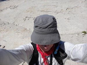
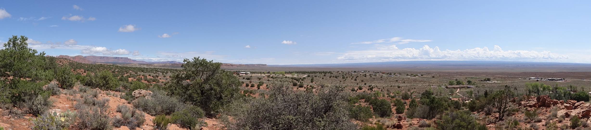
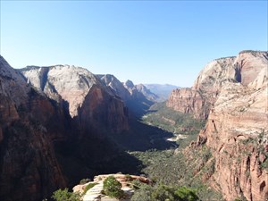
When organizing our summer trip to south west US, we participated to the Coyote Buttes North lottery on May 1st and we disappointed when we lost (more than 120 groups applied for that day!).

During our vacations, at some time, we decided to move from a busy and hot campground in Page to the more quiet Kanab area. It opened a new opportunity to participate to the lottery with better odds (about 30 groups applied) and to win a permit for 4 people (out of the 7 slots still opened at that time).

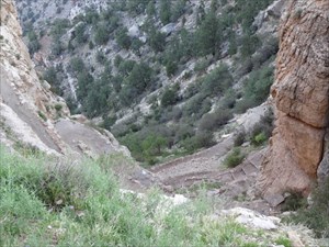
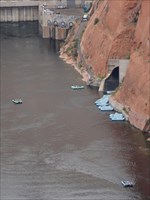
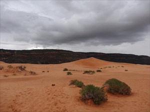
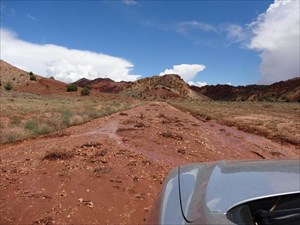
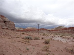
With rains during the night and notice of storms, the next concern was be able to reach the trailhead with flash floods at risk. Fortunately, the dirt road was solid when we drove it in the morning, the second group parking after one using an outfitter (who doesn't count in the 20 permits per day and know how to drive his 4x4 SUV!).

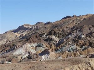
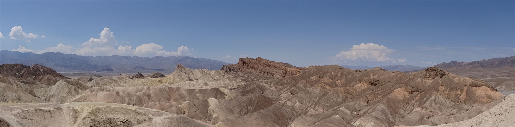
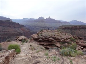
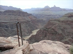
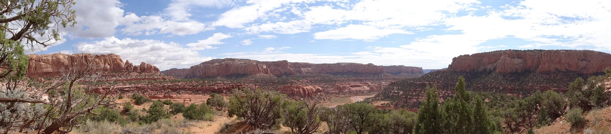
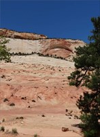
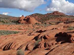
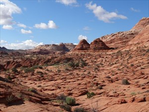
The area is rich with different landscapes and geological features other that The Wave and we tried to explore a little after having collected the cache information and taken the "we've been there" pictures. But the horizons were getting darker and we didn't dare to reach the other earthcache higher in the cliffs.

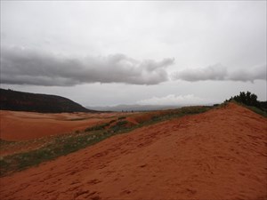
While we were enjoying our visit, it rained somewhere north and we later had to drive past running water, stones and branches that had appeared on the road : we sure appreciated having rent a AWD vehicle and understood the warning of the BLM ranger the day before, saying that the most difficult part of the Wave may be going to the trailhead!

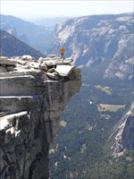
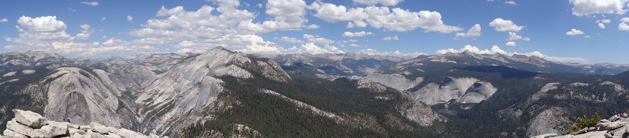
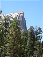
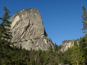
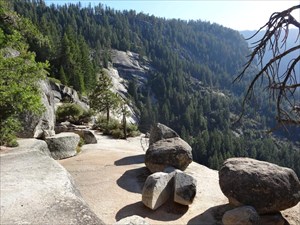
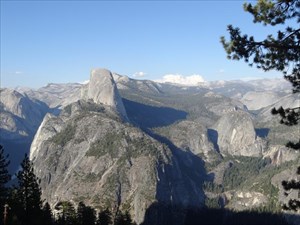
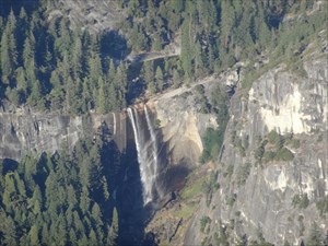
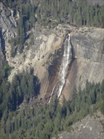
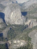
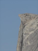
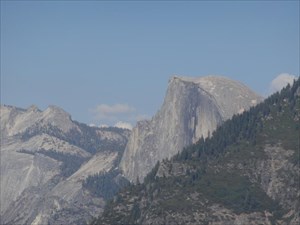
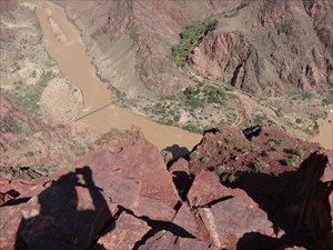
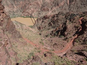
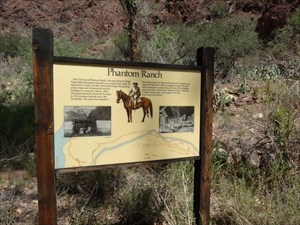
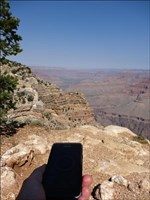
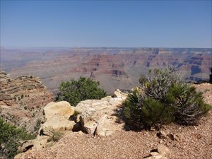
Many thanks for placing the earthcache on that very special place that is one of the hiking highlights of our vacations (along with Half Dome cables in Yosemite, the bottom of the Grand Canyon and a visit to Betatakin asanazi ruins).

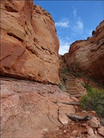
Entering Coyote Buttes North
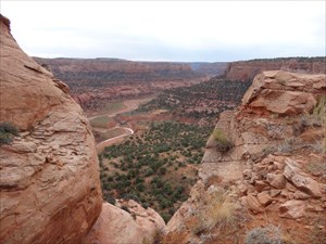
Wave at the horizon!
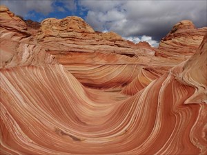
Layers upon layers upon layers
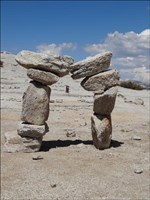
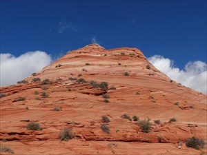
A lone hoodoo
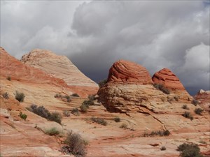
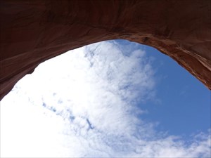
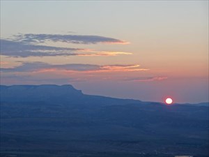
Is it going to rain?
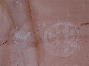
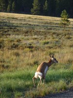
The Wave is inhabited
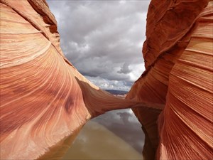
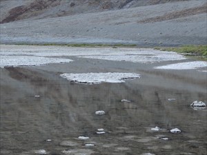
A wave, some still water and possible moving water
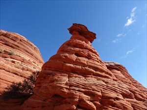
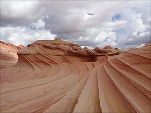
Twist or rock'n roll?
Wave II ?
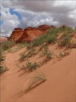
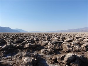
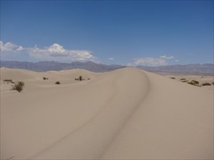
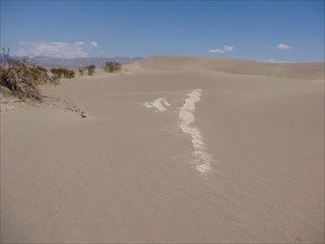
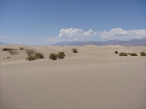
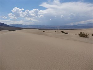
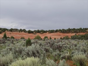
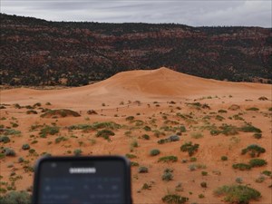
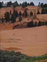
Landscape diversity: dunes
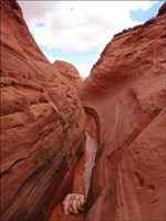
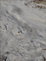
Landscape diversity: mini slot canyon
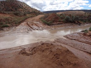
The wash is filling
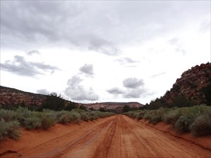
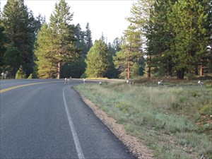
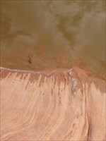
The road used to be "clean" in the morning

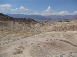
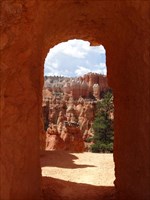
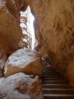
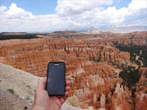
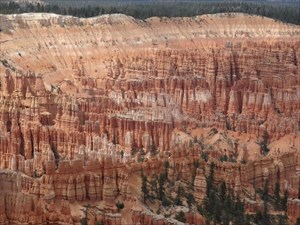
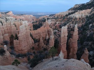
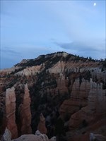
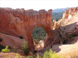
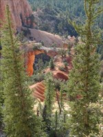
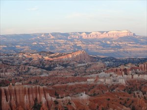
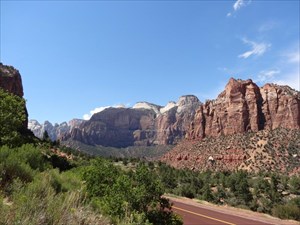
After spending some time using our Coyote Buttes North permit to explore the Wave, we didn't had much time for the other nice features of the area. We just stopped to do this cache before leaving for Bryce and discover more hoodoos there.

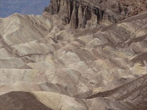
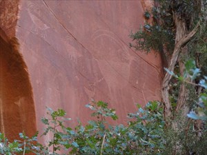
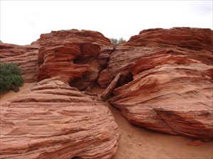
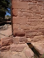
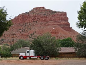
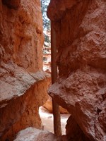
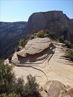
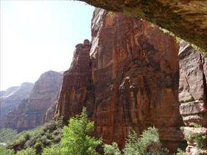
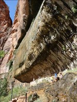
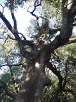
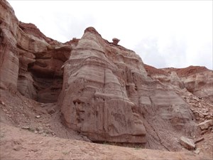
The cliffs close to the cache look very much like what can found in underground caves but seem to be much more fragile, making them a little onimous when seen from below!

Thanks for this big cache!

Where are the stalactites and stalagmites?
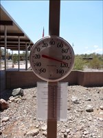
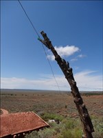
Why stand up electrical poles in this landscape?
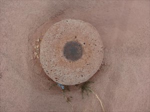
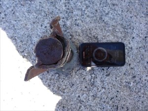
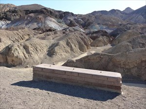
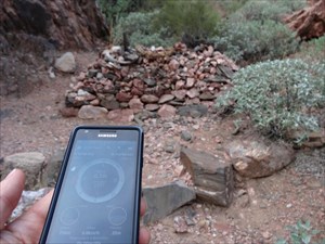
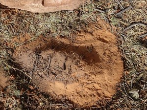
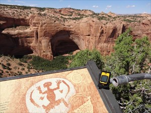
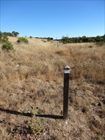
Marker F139

Vendredi 24 août 2012

The last (that was also the first) time that we came here, the view of Bryce Canyon was the good surprise of our vacations, with all the delicates spires enchanting the landscape. Many years later, we weren't disappointed : the charm of the canyon is still working on us, especially when walking among of these natural sculptures.

We followed a logical path from Sunrise to Sunset Point visiting the Queen's Garden and Wall Street finishing by all the nice switchbacks. We've seen some big rocks that seemed the result of an avalanche and wondered if they were the rocks cited in the cache description.

Thank you for adding a geocaching and geological plus to a nice hike.

The garden's door
It's raining rocks!
A tree in Wall Street?
The hard way out

After walking down the canyon, we walked along the rim to discover all the hoodoos and walls from above. The view from Inspiration Point is really beautiful with rows after rows of multicolor spires in the circus toward Sunset Point.

Bryce seems both impressive and fragile : it should inspire us to accelerate the protection of nature and to find a balanced way of life.

Thanks for the cache and the inspiration.

Technological wonder and natural wonders
Sentinels are watching us!

After a day walking among the hoodoos or along the rim, we went to Sunset Point to wait for the sun to disappear. We were not alone to enjoy the changes of light on the rocks of the Bryce amphitheater and on the Aquarius plateau on the horizon.

We then decided to visit this virtual geocache before nightfall : no car on the side road or the parking, no one around, what a change! The light was getting low but enough to enjoy the view on the Fairyland below.

As we wanted to go to watch Sunrise from Bryce Point (and not Sunrise Point!) and then go to Rainbow Point before breakfast the next morning we didn't stay long at Fairyland Point (so many nice point along Bryce plateau!).

Thanks for this quiet view point and cache

It's getting dark, the fairies will soon arrive!
The moon above Boat Mesa

Samedi 25 août 2012

After watching the sun rise over the hoodoos from Bryce Point (better than Sunrise Point?), we decided to visit the south part of the park before breakfast, allowing us to feel alone in nature! We drove directly to Rainbow Point then we stopped at the different viewpoints on the way back. Each had interesting things to see but the best one was the Natural Bridge.

Bryce is incredible in the diversity of the forms created by erosion and in the impression of dynamicity as one can almost feel how the earth is been sculpted by the elements : when will the bridge collapse and form two twin hoodoos?

Thank you for placing this virtual at such an interesting point

Early morning in the park
Do not disturb!
The bridge
A smaller bridge further north

While visiting Bryce, we had noticed on the horizon the pink cliffs of the Aquarius plateau: the sun rose near then and they were the last formation to be illuminated at sunset. With this earthcache, we can know decrypt the landscape we saw and understand how these cliffs and those of Bryce on Paunsaugunt Plateau are related. The schema of the Grand Staircase is nice, we seen a similar one at Kanab's Office of the Bureau of Land Management, spanning a large wall: very useful when visiting southern Utah!

For some unknown reasons, our GPS didn't alert us of the existence of the micro cache. Maybe for the next time (if any).

Thank for the info and the cache

Sunset on Bryce, Aquarius and Powell Point
Sunset behind Powell Point
GPS and Powell Point from the cache
Paunsaugunt Plateau to the north

Entering Zion Canyon from the east is quite an experience : beautiful landscape when following the Co-op and Clear Creek valleys, dark and long tunnel, sudden discovery of the canyon and its white sentinels, nice switchbacks and a great arch! It makes up for the little queue at the tunnel's entrance!

This nice earthcache was the first of a great serie we've done in the park, driving, shuttling, hiking and wading. Thank you!

Another blind arch on our way to Zion
Discovery of the canyon
GPS and blind arch

Dimanche 26 août 2012

Angel's Landing was high on our todo list for our vacations in the US this year. After climbing Half Dome, going down to the bottom of the Grand Canyon and finding The Wave in Coyotte Buttes North, we were quite confident that everybody in the troup would make it to the top.

What a strange trail : it is paved up to Scout Lookout and may be accessible to strollers pushed with determination then after a small sand part transforms directly in some kind of via ferrata! Great fun to climb and great views!

Thanks for placing a virtual at such an interesting spot.

A group of teenagers at the top : angels?
Where are the Narrows?
Searching for food for thought?
A fast way to catch the next shuttle?

After having seen the weeping rock from above (Angel's Landing), we came to experience it from below. What a cool area, "water conditionned" yet eco-friendly! One just have to take care of electronic equipments like a GPS smartphone that doesn't appreciate falling water : what must it be when the fall above the rock is not dry!

Thanks for the cache and the explanations (as we didn't find the information panel!)

The Weeping Rock is down there
Behind the water curtain
A cool balcony with a view
Mind the steps!

After hiking up Angels' Landing in the morning and going to the Weeping Rock, we went further in the Virgin River canyon, past the shuttles' terminus in late afternoon.

At the beach at the end of the "dry" trail, lots of wooden sticks were available to help us negociate the rocky crossings of the river. Being late in the day, not to many people were walking upstream compared to the rush hours commutes on the other side! The water level and temperature was just fine to make the trip fun and enjoyable : what an adventure it must be do go down the whole length of the Narrows instead of just exploring the south end (we forgot to count the number of curves that we negociated and the GPS was a bit lost : ).

Thanks for the cache that led us to feel the action of water from the inside of the canyon

Peak hour at the bus terminus?
Muddy waters
Nice light down there
The trees had to survive the floods
The river is carving the curves
Walking in the water is fun and spectacular!

Lundi 27 août 2012

Leaving Zion for Las Vegas after some nice hikes in the main canyon, we just stop for a last glance back. And to do a quick geocache.
Thanks for reminding us to drive cautiously and enjoy the gorgeous landscape!

Road to Zion Canyon
Can it go faster than 20 MPH?

During our vacations in the south west states of the US, we had two stops at Las Vegas, two weeks apart. After some time in Grand Canyon, national parks and deserts, walking the Strip at night with all the people, lights and animations makes for a change.

Coming from France, we had to visit the Paris Las Vegas Casino. It didn't make us homesick but was a good opportunity to log another american cache.

Thanks for contributing to good trans-atlantic relations!

More lights than on the original one!
Doing some food shopping in Paris

What disappointment when visiting Caesar Palace, they were much less hostesses in togas than in my memories dating from 28 years! Watching the various Caesar statues wasn't so entertaining. But when arriving at the cache spot, the fun factor raised in the night's heat! Apollo is the god of music, light and oracles : that seems quite appropriate for Las Vegas! But it could have borrowed a vine leaf from Dionysus to replace the missing toga!

Thanks for this fun virtual

A cool attitude, roman style!
Who said the Emperor had no clothes?

Although we've visited many time the Alps, we've never been to the Lake Como area, one of the most romantic destination in the world! Being in Las Vegas, after going to Venice and Rome, we couldn't miss this lake!

We stayed in the lake side to watch two shows with different musics, one of them quite appropriately from Ennio Morricone (mixing Italy and the West). We didn't stay long enough to test all the soundtracks!

Thank you for the cache close to the attraction

Nice blue lights
Stylish fountains
Reaching the climax

Mardi 28 août 2012

On the trail between Las Vegas and Los Angeles, our stagecoach stopped at Calico to let the horses cool down and get some food for the 4 passengers (the Daltons?) at the nearby saloon (we enjoyed throwing peanuts coats on the floor). Some individuals started to search for a safe place to do some suspicious activity. They succeeded without an explosion and without finishing in the nearby jail.

Thanks for this cache in an interesting town.

Water must have been as precious as silver!
Lot of possible places but none very safe
The cache is guarded by the sheriff!

Even if our trip in South West US didn't include an extended stay in Los Angeles, being more focused on natural sites, as we just had been listening to the MP3 book "Echo Park" featuring Harry Bosch during our long road trip in the desert, we had to make a quick stop at the observatory to try to spot the park and Bosch's house (we couldn't find it in the Hollywood hills!).

We didn't had enough time to visit the museum but finding the answers on the famous astronomers orbiting between Uransu and Pluto was rapidly done and the cache quickly found.

Thank your for this scientific and scenic cache.

No fog over LA
Observatory or spacecraft?
Nice solar system model

Mercredi 29 août 2012

Following the Californian coast from Los Angeles to San Francisco in the last days of our vacation in southwest USA, we stopped at Pismo Beach to picnic along the beach.

We were surprised to find that motor vehicles were allowed to go to this public beach : we don't know of such a situation along the coasts of France.

Thank you for this cache with a nice view on the bay

No lifeguard on duty?
This cache is not a drive-in
Repairing a car on the beach

On our way up the Highway One, it took longer than expected to arrive to Monterey, our destination of the day : we HAD to stop to watch sea elephants and whales! We decide to do less geocaching but we couldn't miss this one at a such lovely and scenic spot.

Thank you for placing a cache there.

Cove and GPS
What a view!

Jeudi 30 août 2012

For the last visit of our vacations in the US, we decided to see some evidences of the famous San Andreas Fault that is critical for California. After the experience of numerous of tourists (including ourselves) in some location, visiting an empty preserved area was very pleasant and it was easy to do a physical cache. We were surprised to discover that there may be mountain lion around, it adds a spicy note to outdoors activities like geocaching!

Thank you for the quiet and shaded spot

Another scar in the landscape
This scar is almost a century old!

Last hike of our 3 weeks vacations in south west USA, to find evidence of seismic activity in California. It's a great trail when followed with the information leaflet and it helps understand what happened and what changed in the landscape. We late discovered on the web that there are small earthquakes everyday along the fault but we didn't noticed any movement!

The pond is empty, not surprising given that the environment is very dry at that time of year (fire protection in the meadows, ranger that seems to be actively watching the area). In the central part (approximately 9 meters long), the soil was covered by some kind of thick grass, with tall round leaves, different from the graminae found in the prairies of the ridge.

Thank for this nice and entertaining geology class.

No water but evidences of moisture
Nice public area : the steps or the barriers?

Found the cache while hiking the San Andreas Fault trail and learning to find traces of seismic activities in the landscape. Great cache that consistent with the geological focus of this area.

Thanks for our last US cache before flying back to Europe.

Nice tree near nice cache
One foot on each plate!

Source : GarenKreiz/Geocaching-Journal @ GitHub (CC BY-NC 3.0 FR)